Wujal Wujal Buried in Floodwater
Wujal Wujal Floods
No
Is your life today what you pictured a year ago?
Cyclone Jasper approaches Cooktown
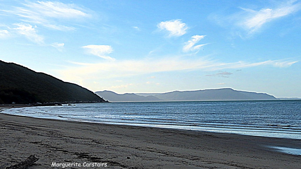
Quarantine Bay Cooktown

The Bay was called Quarantine Bay because it was thought it was used as a quarantine area, but it wasn’t because the bay was too shallow and another location on the Endeavor River in Cooktown did become the quarantine area. However, the name has stayed and people assume the Bay was used as a quarantine Base.


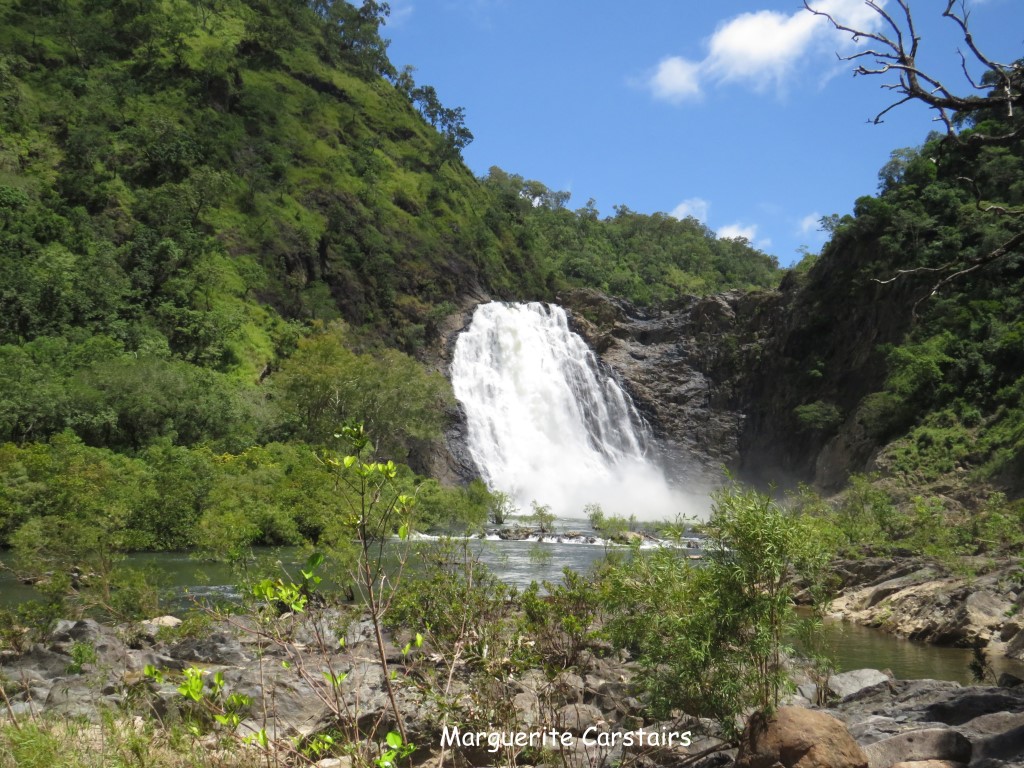
Wujal Wujal

Wujal Wujal, sometimes spelt Wudjil Wudjil, is a rural town and locality in the Wujal Wujal Aboriginal Shire, Queensland, Australia. It is an Aboriginal community. In the 2021 census, the locality of Wujal Wujal had a population of 276 people https://wujalwujalcouncil.qld.gov.au/
Wujal Wujal is the local Kuku-Yalanji clan name meaning ‘many falls’, highlighting the many sacred waterfalls in our landscape. This image also captures our multifaceted region of ranges, rivers and reef. It reflects our sparkling coastline and abundant wildlife. And most of all, our many peoples and languages. Our ancestry dates back on our traditional lands for thousands of years and our indigenous language is still spoken in the community. Our local clans are the Kuku Nyungul and Jalunji peoples and the Eastern Kuku Yalanji who have native title to the Wujal Wujal area.


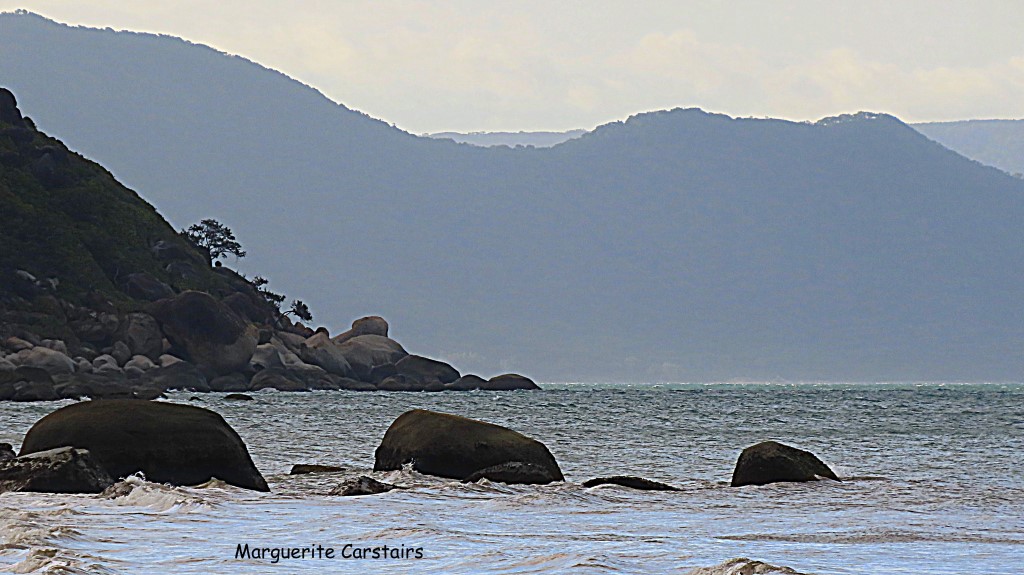
Walker Bay Cooktown

Walker Bay Beach runs for about three and a half kilometres. It begins on the North side of the mouth of the Annan River and finishes at the rocks on the Southern end of Monkhouse Point. Beachsafe.org.au lists it as ‘Golf Course’…due to the Walker Bay links at the Northern section. If you search the Beach Safe site, it is beach number qld0644. https://thegreenbus.wordpress.com/2011/04/10/a-visit-to-walker-bay-beach-cooktown/
Getting to Walker Bay beach is pretty straightforward, but you’ll need a 4WD unless you intend on walking. Head South out of Cooktown and turn left onto Quarantine Bay Road. Head down a km or two and hang right onto the golf course road. About 500 metres or so you’ll see a well worn track going off to the right. Head down the track and eventually you’ll end up on the beach. Take care on the track and drive slowly. It is very narrow and has many blind corners and crests. You shouldn’t need FWD, but you will need the clearance due to ruts, tree roots and stuff. We got down to the end of the track to the beach, which then splits two ways. You can drive North to the point, or head South to the mouth of the Annan River. The Southern end is a favourite for kite surfers and board riders when the swell allows.
OK, so we went to the beach. Our art installations are still standing! We’ve had some big tides this week, so I expected they’d be washed away. We also just missed a beach loving crocodile. See the pics of the tracks below. Jack the dog found a 30 centimetre Seahorse exoskeleton too. Oh, and compare the big stump pic to the one in our previous Walker Bay post. This beach is very fluid. Last time we went there were two creeks flowing into the sea, but now there is just the one. That’s where the croc tracks came from. https://thegreenbus.wordpress.com/2011/04/18/another-walk-at-walker-bay/
Walker Bay is at a latitude of -15.55317 decimal degrees and a longitude of 145.29046 decimal degrees (GDA94 datum, which is for many practical purposes equivalent to WGS84).
Cooktown Golf Club is a nine hole course with dual tees. Locally constructed on the coastal dunes, the course has been built in and around the tropical bushland that boarders Walker Bay and the Annan River. Located beside Monkhouse Point, with the imposing Mount Cook as the constant backdrop, the natural beauty of the surrounds make this links type course a must for golf adventurers and holiday makers alike. However, there is a catch to all this beauty. This is the most northern golf course on the East Coast, and the wind blows from south east around 20 knots most days.


Quarantine Bay Beach Cooktown

Quarantine Bay owes its name to the fact that it was first used as a quarantine section for passengers of ships with diseases. Covered with pebbles and shells, this beach is fantastic for fishing and swimming thanks to its warm and shallow waters. Quarantine Bay is located just seven kilometres south of Cooktown, off the main Highway to Cairns.
So say all references online, however, in actuality, there were no quarantine locations here..as the bay waters were too shallow for Quarantine vessels, and also the threat of being able to walk ashore at low tide. Quarantine was at Leprosy Creek in Cooktown, not at Quarantine Bay. There were leprosy cases at Cooktown in 1897 to 1908. You can do a tour up Leprosy Creek with Riverbend Tours


https://www.tropicalnorthqueensland.org.au/articles/cooktown-beaches/

You must be logged in to post a comment.